Mount Major is located in Alton, NH. About 1 hour from Portsmouth, NH, 2 hours from Boston, MA, and 1.5 hours from Portland, ME.
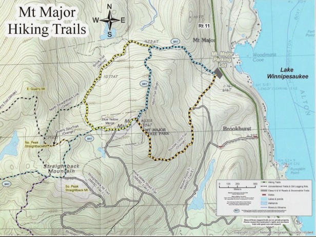
Total Distance: 3.8 mile loop (full loop, longest route) 3.2 (blue trail and orange trail)
Time: Approx 3 hours with four 5 minute breaks and a rest for lunch
Difficulty: Moderate
Family Friendly 4/5
Dog Friendly Meter: 3/5
Elevation: 1785 feet
![]()
![]()
![]()
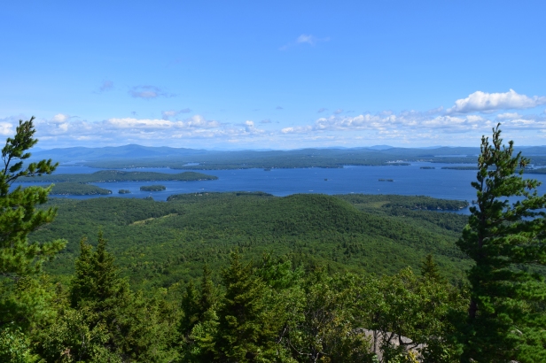
My wife had never seen Lake Winnipesaukee until I took her up Mt Major. It was one of the first hikes we did as a married couple. Our day began with a conversation about how stressed out we both were coming back from our honeymoon, and how we wanted to enjoy the final weekends of summer. There’s no better place to do that than the lakes region of New Hampshire. I had done this hike before in college and figured the best way for Danielle to view the lake was from the summit of Mount Major.
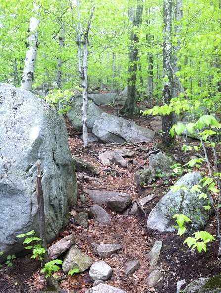
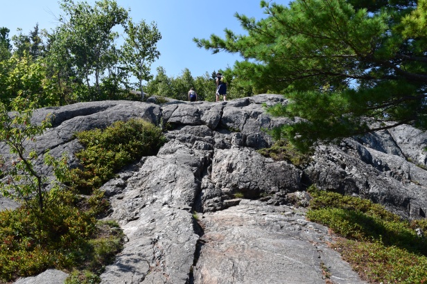
As you can see by the map, there are many avenues of approach that reach the summit. The least distance is the blue trail (Main Mt Major Trail), which is 3 miles round trip from the summit and back to the parking lot. Time wise it is about 2-2.5 hours total depending on speed, agility, and break schedule from summit to trail head. Upon entry of the trail, the first half mile is nothing but severely eroded sections that can be difficult to maneuver and slippery when wet. There are some areas that allow slightly better footing than others but you definitely have to pay attention to where you are stepping. For this reason, hikers who had their dog on leash were not enjoying their experience. Dogs were moving faster than their owners and tugging them along these slippery rocks. For obedient dogs who listen to voice commands, it was a little easier for their owners to multitask.
Reaching the summit from all trails consists of climbing some pretty steep and eroded areas. Brook Trail (1.7 miles) has a stream to cross and water levels can be high depending on what time of year it is. For active breeds these steep inclines are easier to handle. For older dogs they are much more difficult. I saw a lot of owners carrying their dogs up the mountain during the steep portions of the summit if their dogs were under twenty pounds.

Many people take the blue trail up, and a different trail down, and that is what Danielle and I did. We decided to take the Boulder Loop Trail down once reaching the summit, which is colored orange on the map. Our total hike was 3.2 miles long.
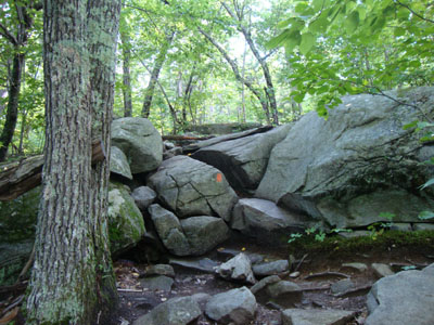
The Boulder Loop Trail got its name for a reason. It descends steadily through areas with ledges and boulders for about half a mile. At one point you have to squeeze between two boulders, which seems to mark the end of the rat race. There were still some boulders to maneuver around but the paths were clear and not steep enough to be considered strenuous. The last mile (roughly) is a steady woods trail that will bring you across two plank bridges. The woods trail is groomed and often used for snowmobiling in the winter so it was a nice break from dealing with the erosion and difficulty of the blue trail.
No matter which trail is used for decent, ledges and steep inclines are what make these trails moderate. Boulder Loop seemed like the best trail to use for our furry friends because it was a break from some of the erosion and rock jumping we experienced on the blue (Main Mount Major) trail. The boulders were easier to work around and half the trail was a flat walk back to the parking lot.